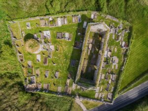
A cashel, for the uninitiated, is a stone-walled ringfort, a type of enclosed farmstead common in early medieval Ireland. Within this one sits a subrectangular hut site, measuring roughly 4.5 metres north-east to south-west and just 1.5 metres across, its inner face built from fairly regular blocks rising to a maximum height of 0.8 metres. By any objective measure it is modest, almost cramped. Yet for long enough that it appears on both the first Ordnance Survey six-inch map of 1842 and the later Cassini edition of 1920, this structure has carried the name Dermot and Grania's Bed.
The name belongs to one of the most celebrated elopements in Irish mythology. Diarmuid and Gráinne, fleeing the pursuit of the ageing warrior Fionn Mac Cumhaill after Gráinne's infatuation with the younger Diarmuid, were said to have slept in a different hollow or stone enclosure every night of their wandering. That legend left its mark on the landscape with considerable generosity; megalithic tombs, cave openings, and stone enclosures across Ireland have inherited the same name, each one a local claim on a story that was never fixed to any particular place. The Clare example is a hut site rather than a megalith, and scholars have treated it cautiously. It was listed as a possible hut site in the Record of Monuments and Places in 1996, a designation that conveys informed uncertainty rather than dismissal. The antiquarian Thomas Johnson Westropp, writing in 1905, recorded that only a single slab in the wall was set upright, and noted an oblong foundation within the interior, its surface lying some 1.21 metres below the surrounding cashel ground level. By 1999, that interior was filled with rubble. Partly overlying the south-west edge of the hut sits a separate subcircular feature, defined by an earth and stone bank up to two metres wide, which adds another layer of complexity to a site that resists easy classification.
What is striking here is less the structure itself than the persistence of the name across nearly two centuries of mapmaking. Ordnance surveyors in the 1840s did not invent local folklore; they recorded what people told them. That this small, ambiguous enclosure within a cashel was already known as Dermot and Grania's Bed when the first surveyors arrived suggests a tradition with some depth, even if the archaeology beneath the rubble remains unexcavated and the story, as always, belongs to everywhere and nowhere at once.