Site of Naul Inn, Westown, Co. Dublin
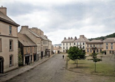
The rectangular stone building marked as 'Hall' on historic Cassini maps in the village of Naul may have once been the original Naul Inn, a coaching house that served travellers on the Dublin to Drogheda road for centuries.
Site of Naul Inn, Westown, Co. Dublin
Historical records suggest an inn has stood at this location since at least 1641, when the Deposition of Katherine Magee identified Christopher Cruse as an innkeeper at “the Naall”. The building appears on Rocque’s 1760 map of County Dublin, and by 1787, proprietor John Tiernan was advertising in the Dublin Evening Post that he had fitted up his house and stables “in the best manner” for gentlemen travelling the northern roads, proudly noting that the Naul road was turnpike free.
The structure that stands today is a fascinating multi-period building that likely dates from the late 17th or early 18th century. The main hall is aligned east to west, with its gable end facing the road to Drogheda, whilst a public house attached to its north side runs perpendicular in a north to south alignment. This irregular layout, combined with a tall projecting chimney stack midway along the northern wall, suggests the building evolved over time to meet changing needs. An 1825 drawing by James D. Harding, based on sketches by Robert O’Callaghan Newenham, shows the inn with its distinctive tall chimney and rounded gable facing the road, capturing its appearance before later alterations.
The two-storey stone building underwent significant changes in the 1940s when the roof was reconstructed and the gables were raised to create a Dutch Billy effect; a distinctive architectural style characterised by its curved or stepped gable ends. Despite these modifications, the building retains much of its historic character and continues to serve the community as a public house, maintaining its centuries-old tradition of hospitality at this important crossroads in north County Dublin.
Good to Know
Tags
Visitor Notes
Added by
Pete
Rocque, J. 1760 An Actual Survey of the County of Dublin, on the same Scale, as those of Middlesex, Oxford, Berks and Buckinghamshire. Available at http://sdublincoco.maps.arcgis.com/apps/webappviewer/index.html?id=e0c5595b033341dea7661e248d2e9ee9// [Accessed 21 September 2016]


