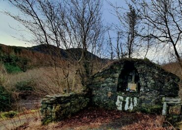
Church, Magheracar, Co. Donegal
In the townland of Magheracar, County Donegal, the faint memory of a medieval church lingers in the landscape, though no physical trace remains visible today.
Church, Magheracar, Co. Donegal
The site, recorded on 19th-century Ordnance Survey maps, once occupied a slightly elevated patch of pasture land. Where the church and its burial ground once stood, a modern bungalow now sits, itself built on the footprint of a late Victorian farmhouse. The only cartographic evidence of the ecclesiastical site comes from the third edition of the OS 6-inch map, which marked its presence before it vanished entirely from the physical landscape.
Archaeological testing in 1999, conducted as a planning requirement for new construction near the recorded monument, revealed no buried features or artefacts in the excavated trenches. However, the landowner had preserved several intriguing stone fragments that likely represent the sole surviving physical evidence of the lost church. Among these relics are a piece of a small rotary quern used for grinding grain, a stone basin, and perhaps most significantly, an architectural fragment bearing distinctive ribbed moulding typical of late 12th or early 13th-century doorways. This decorative stonework bears striking similarities to architectural elements from the nearby Assaroe Abbey, suggesting possible connections between the two religious sites.
The church at Magheracar represents one of countless small ecclesiastical sites that once dotted the Irish countryside, serving local communities for centuries before disappearing from both map and memory. Whilst the building itself has been lost to time and development, the preserved stone fragments offer tantalising glimpses into its medieval past; the quern speaks to daily life and sustenance, the basin to ritual and ceremony, and the doorway moulding to the architectural ambitions of a small rural church that sought to echo the grander style of its monastic neighbours.


