Castle, Tyrrellstown, Co. Westmeath
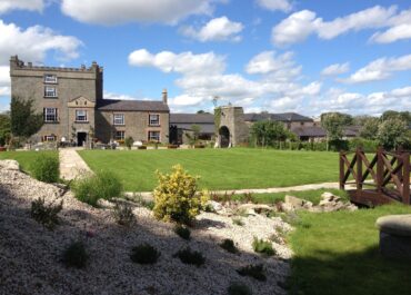
Tucked into the southwest corner of Tyrrellstown House's farmyard lies what remains of a medieval castle, now little more than a fragment of wall incorporated into the later building.
Castle, Tyrrellstown, Co. Westmeath
The castle appears on the Down Survey barony map of Fartullagh, though curiously it’s absent from the Parish Map and receives no mention in the Terrier, suggesting its importance may have already been waning by the 17th century.
When archaeologists examined the site in 1976, they found the castle ruins had been absorbed into Tyrrellstown House, forming what appeared to be a small projecting turret or tower wing. The surviving walls, built from rubble stone and measuring about 1.5 metres thick, contained a narrow doorway typical of defensive architecture. At that time, a short stretch of wall, roughly 3 metres long and 6 metres high, ran south from the house’s southwest corner; the rest had apparently been demolished some years earlier.
Today, the monument stands in a ruinous state with no clear evidence of additional early walls beyond what was documented in the 1970s. A broken rectangular stone basin or trough, possibly associated with the castle, rests on a nearby garden wall; a tantalising hint at the domestic life that once animated these now silent stones. The OS 25-inch map shows the ruins forming the southwest corner of the farmyard quadrangle, a practical repurposing of medieval masonry for agricultural use that’s common throughout rural Ireland.


