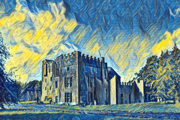
Castle, Dunegan, Co. Westmeath
Co. Westmeath |
Tower Houses
Perched dramatically on the northeastern tip of a narrow ridge, 106 metres above sea level, the ruins of Dunegan Castle command sweeping views across the Westmeath countryside.
The castle's name derives from Dun Thadgain, meaning Thadgain's Fort, after a figure said to have occupied this strategic hilltop during the 9th century. What remains today is primarily the western gable wall and fragments of the north wall, standing some six to seven metres high; testament to what was once a formidable rectangular tower house with an adjoining bawn wall.
Historical records paint a vivid picture of the castle's past. The 1654 Down Survey map shows it as a tower house with a large bawn, already noted as ruins but still substantial enough to merit careful documentation. The castle came into the possession of Hubert Magawly in the early 1600s, following the deaths of his father Awly and half-brother Christopher. The Magawly family held Dunegan as their seat until Cromwellian times, when ownership passed to a branch of the Homan family from Shurock. This line of occupation continued remarkably until March 1826, when fire finally brought an end to the castle's inhabited life.
The surviving architecture reveals fascinating construction details; thick walls of roughly coursed, mortar bonded limestone rubble, with traces of a plinth at the base. Two lintelled fireplaces mark the first and second floor levels in the western wall, their chimneys partially intact. A garderobe chute, now exposed by stone robbing at the southwest corner, and various recesses and window openings hint at the domestic arrangements within. Surrounding the main structure, sod-covered foundations trace the outlines of additional buildings, including a rectangular structure adjoining the south wall, whilst further foundations at the base of the ridge suggest a more extensive medieval complex, now partly obscured by old cultivation ridges and woodland.
Visitor Notes
Added by