Castle, Knockdrin, Co. Westmeath
Co. Westmeath |
Tower Houses
The townland of Knockdrin in County Westmeath has a layered history that stretches back centuries, though what you see today might not be quite what it seems.
Originally known as Monelea, this area was recorded in the Down Survey maps of 1655-9 as belonging to Andrew Tuite, an Irish Catholic landowner. The survey depicts a medieval castle standing beside an old roadway near the River Gaine in the northern part of the townland, roughly where the 19th century Knockdrin Castle would later be built.
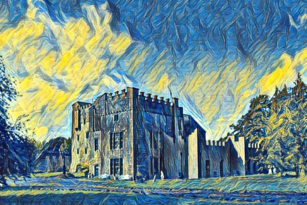
Today, visitors can find a curious rectangular tower tucked into the southeast corner of a walled orchard, about 100 metres northeast of the Victorian-era Knockdrin Castle. Measuring 7.5 by 5 metres and reaching up to 9 metres high, this structure poses something of a historical puzzle. Its walls are punctuated by narrow window openings with brick surrounds on the south side, but experts aren't entirely certain of its origins; it could be the remnants of a genuine medieval tower house that's been modified over the centuries, or it might be a 19th century folly built in the Gothic revival style to mimic medieval architecture.
Adding to the confusion, there's another structure marked as a castle on Ordnance Survey maps about 980 metres to the southeast, though this appears to be nothing more romantic than an 18th or 19th century icehouse. These misidentifications and architectural mysteries are common throughout Ireland, where centuries of building, rebuilding, and repurposing have created a landscape where distinguishing between authentic medieval ruins and later romantic recreations requires a keen eye and often, a healthy dose of scepticism.
Visitor Notes
Added by