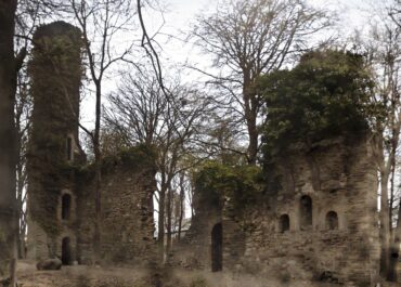
Lost Round Tower at Emly, Co. Tipperary
Ireland's most precisely documented round tower destruction witnessed King Turlough O'Brien's 1058 assault that burned both bell tower and church at sacred Emly; though a mysterious 1681 sketch hints that something medieval may have stubbornly survived 623 years of ruin.
Lost Round Tower at Emly, Co. Tipperary
This vanished round tower at Emly represents one of the most historically significant lost examples, documented through both medieval annals and 17th-century visual evidence. The tower’s destruction in 1058 during a major military assault, combined with possible visual documentation from 1681, provides a rare combination of historical and artistic evidence for a completely disappeared monument
The Destruction of 1058
The Annals provide dramatic documentation of the tower’s violent end, recording that in 1058 “the ‘cloig-theach’ at the monastery at Emly was completely burnt, together with the church, by Turlough O’Brien.” This represents one of the most precisely documented destructions of an Irish round tower, carried out during the broader military campaigns that characterized 11th-century Irish politics.
Turlough O’Brien (Toirdelbach Ua Briain) was one of the most powerful Irish kings of the 11th century and later became High King of Ireland. His systematic destruction of both the round tower and church at Emly indicates this was not random violence but a calculated assault on one of Ireland’s most important ecclesiastical centers, intended to demonstrate political dominance and eliminate a symbol of rival authority.
Emly’s Ecclesiastical Importance
The monastery at Emly held exceptional significance in Irish Christianity, traditionally founded by St. Ailbe and serving as one of the premier ecclesiastical centers in Munster. The deliberate targeting of Emly’s round tower by such a prominent king reflects the site’s continued importance and the symbolic value attached to destroying its most visible monument.
The burning of both church and round tower together suggests O’Brien intended to eliminate Emly as a functioning religious center, recognizing that these structures represented the monastery’s spiritual authority and practical capabilities.
Thomas Dineley’s 1681 Sketch
The potential visual evidence comes from Thomas Dineley’s 1681 sketch showing “the medieval cathedral from the NE with the E gable in the foreground. A ruined structure is depicted immediately to the NW of the cathedral, at the W end of the N side aisle.” Round tower expert Barrow speculates this ruined structure “may be the remains of the round tower.”
This visual evidence, if correctly interpreted, would be extraordinary—suggesting that substantial remains of the round tower survived over 600 years after the 1058 burning. Such survival would indicate either that the fire damage was not complete or that the tower was partially rebuilt after O’Brien’s assault.
Problems with the Visual Identification
However, several factors make Barrow’s speculation questionable. The 623-year gap between the documented burning in 1058 and Dineley’s 1681 sketch seems unlikely for substantial round tower remains to survive, particularly given the description of “complete” burning in the annals.
The ruined structure Dineley depicted could represent various other medieval buildings—church extensions, bell towers, domestic buildings, or defensive structures—that were more likely to survive in ruined form near the cathedral. Without distinctive circular characteristics clearly visible in the sketch, positive identification as round tower remains is highly speculative.
Alternative Explanations
The ruined structure in Dineley’s sketch more likely represents remnants of other medieval buildings that were part of the cathedral complex. Gothic church architecture often included subsidiary structures, bell towers, chapels, or domestic buildings that could appear as ruins by the 17th century.
If any round tower-related structure survived to 1681, it might represent a later replacement built after the 1058 destruction rather than remains of the original burned tower.
Historical Context of the 1058 Attack
The destruction of Emly’s round tower occurred during a period of intense political competition among Irish kingdoms, when ecclesiastical centers often became targets due to their wealth, symbolic importance, and political connections. O’Brien’s assault represents the weaponization of religious sites in broader territorial conflicts.
Archaeological Implications
The tower’s location is described as “unlocated within Emly,” indicating that despite historical documentation and possible visual evidence, no physical traces have been identified through modern archaeological investigation. This absence suggests either complete destruction and removal of materials or burial beneath later development.
Methodological Cautions
The Emly case illustrates the challenges of interpreting historical visual sources for archaeological identification. While Dineley’s sketch provides valuable documentation of 17th-century conditions at Emly, using it to identify specific medieval structures requires considerable caution and supporting evidence.
Good to Know
Location: Emly, County Tipperary South (unlocated within town)
Status: Destroyed 1058, location unknown
Historical destruction: 1058 AD by Turlough O'Brien (burned with church)
Possible visual evidence: Thomas Dineley sketch (1681) showing ruined structure near cathedral
Expert assessment: Barrow speculation about ruins identification (questionable)
Current status: Unlocated despite historical documentation
Archaeological significance: One of the most precisely documented round tower destructions in Irish history
Tags
Visitor Notes
Added by
Pete
White, J.D. 1892 Anthologia Tipperariensis. Cashel.
Lennox Barrow, G. 1979 The round towers of Ireland: a study and gazetteer. Dublin. The Academy Press.


