Round Tower at Clondalkin, Co. Dublin
Ireland's most slender round tower stands on the site of a Viking fortress stormed in 867 AD, its original medieval cap intact after surviving nearby gunpowder explosions and bearing the scars of a medieval mason's curious architectural mistake.
Round Tower at Clondalkin, Co. Dublin
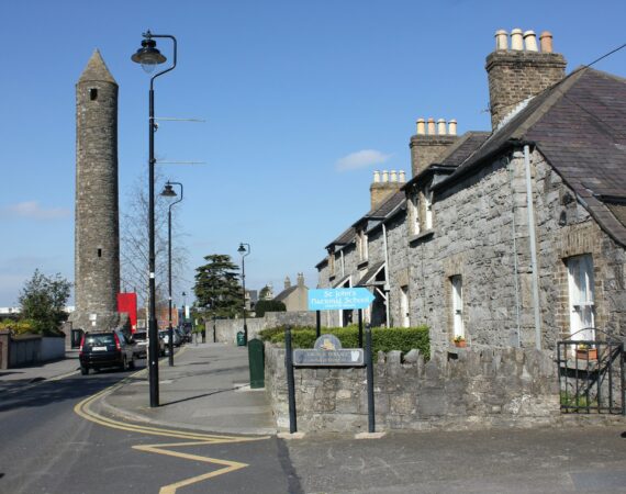
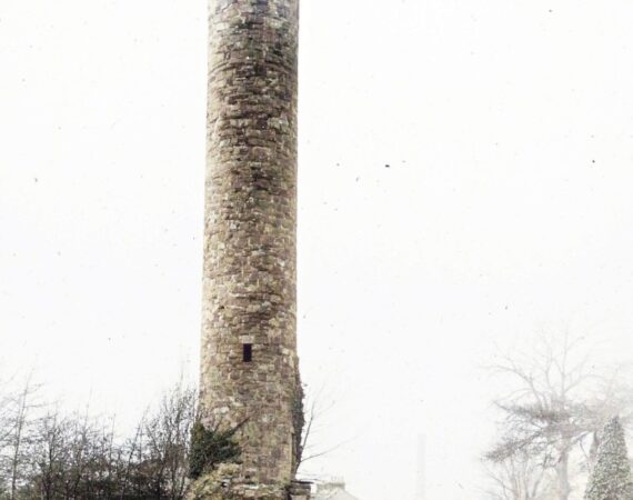
Standing beside Tower Road opposite St. John’s Anglican Church, Clondalkin’s round tower represents one of Ireland’s most historically significant and architecturally important surviving examples. Rising 27.5 meters with a base diameter of 4.4 meters, it’s built from roughly coursed hammer-dressed Dublin calp limestone and is notable for being exceptionally slender among Irish round towers.
Historical Foundation and Viking Period
The tower stands on the site of a monastery founded in the 7th century by St. Mochua (Cronan), with abbots first mentioned in annals during the 8th century. The monastery’s importance is underscored by dramatic historical events: it was plundered by Vikings in 833, and shortly afterward became a Viking base. In 867, the annals record a pivotal battle when “Amlaib’s fort at Cluain Dolcain was burned by Gaithine’s son and Mael Ciarain son of Ronan, and the aforesaid commanders caused a slaughter of a hundred of the leaders of the foreigners.” This makes Clondalkin one of the few recorded Viking rural settlement sites in Ireland, though the exact location of their fort remains unknown.
Architectural Significance
According to architectural historian Lalor, Clondalkin belongs to the early 11th-century phase of round tower construction, characterized by lintelled openings that preceded the later arched doorways and Romanesque decoration. It’s “the finest and only complete tower in the Dublin area” and crucially important as the only complete tower whose cap has never been reconstructed—making it invaluable for understanding original medieval construction techniques.
Unique Features
The tower exhibits several distinctive characteristics. Its drum shows an unusual concave entasis (a slight narrowing that widens again below the cornice), which Lalor suggests was likely a builder’s error. The interior has an almost tube-like profile with minimal floor offsets—a rare feature paralleled only at Glendalough. Originally five stories high, later remodeling reduced this to four floors, ignoring the position of two original levels.
18th-Century Modifications
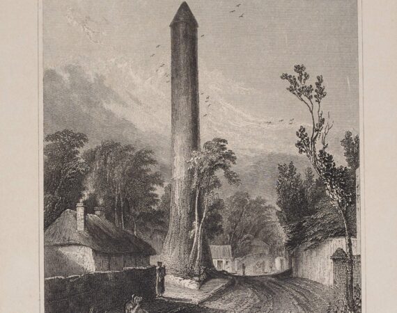
The base is surrounded by a one-meter-wide circular masonry buttress rising 3 meters high, with external steps cut into it leading to the doorway 3.9 meters above ground. These modifications, probably dating to the 18th century, were added for structural support and easier access. The tower remarkably survived a nearby gunpowder mill explosion in the late 18th century that demolished the existing parish church.
Construction Details
The east-facing doorway features a well-articulated granite doorcase with four jamb stones on each side, while the original second and third floor windows are also lintelled with inclined jambs. The bell-floor has four rectangular windows facing the cardinal points, now fitted with modern glazing. The cap, described as “probably the most perfect to survive,” sits at a less acute angle than other examples and rests on a conventional cornice.
Historical Documentation
The tower appears in Samuel Molyneux’s survey drawing from around 1709, providing valuable historical documentation of its appearance. By 1657, the Down Survey described it as a “high watch tower” standing alongside only the stump of a castle and some thatched houses.
Good to Know
Location: Tower Road, Clondalkin, County Dublin
Height: 27.5 meters
Date: Early 11th century
Historical founder: St. Mochua (Cronan), 7th century
Unique features: Original medieval cap (never reconstructed), Viking historical associations
Status: Complete and accessible (floors and ladders to top)
Tags
Visitor Notes
Added by
Pete
Photo by Chris Kofoed on Unsplash
Bradley, J. & King, H. (1988) Urban Archaeological Survey, Dublin, Volume 4. A report commissioned by the Office of Public works (Unpublished).
Barrow, G.L. 1979 The round towers of Ireland: a study and gazetteer. Dublin. The Academy Press.
Ua Broin, L. 1944 Clondalkin, Co. Dublin and it’s neighbourhood. Journal of the Royal Society of Antiquaries of Ireland 74, 191-218.
Sherlock, C. 1906 Clondalkin. Journal of the Kildare Archaeological Society 5, 1-11.
Lalor, B. 1999 The Irish round tower. Wilton, Cork. Collins Press.
AU (1983) – The Annals of Ulster to 1311, ed. S. Mac Airt and G. Mac Niocaill (Dublin 1983)
Gwynn, A. and Hadcock, R.N. 1970 (Reprint 1988) Medieval religious houses of Ireland. Dublin. Irish Academic Press.

