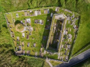
The structure measures roughly 8.8 metres north-west to south-east and 5.75 metres across, with walls about a metre wide built in a double-faced style, meaning the wall has two dressed stone faces with fill between them, a technique associated with more permanent or deliberate construction. A gap on the north-north-west side, around 2.2 metres wide, may once have served as an entrance, and collapsed stonework along the southern perimeter still includes long structural slabs ranging from just under a metre and a half to nearly two metres in length. Whether it was a dwelling, a shelter, or something else entirely, nobody is quite certain.
The site sits on a gently south-west-facing slope with Leamaneh hill visible to the north-north-west and higher ground rising about a kilometre to the east, with a ridge some three kilometres to the south cutting off the longer views in that direction. About 98 metres to the north stands a cashel, a type of stone-walled enclosure, usually circular or oval, that in early medieval Ireland typically served as a fortified farmstead or settlement. The proximity of the two structures raises obvious questions about whether they were ever used together or by the same community, but the record stops short of claiming a connection. The relationship between the two remains a matter of inference rather than evidence.