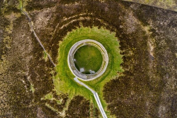
Hillfort, Cumber Hill, Ballymacmurragh, Co. Offaly
Co. Offaly |
Forts
Perched dramatically on a steep, heather-covered hilltop at the eastern edge of the Slieve Bloom Mountains, this ancient hillfort commands sweeping views across the surrounding countryside and several tributaries of the Camcor River. The circular fortress, covering approximately 0.8 hectares, represents a formidable Iron Age stronghold that once dominated this strategic position in County Offaly. Its impressive double defensive system consists of two earthen ramparts separated by ditches, creating a formidable barrier that would have challenged any would-be attackers approaching the 74-metre-wide enclosure.
The fort's defences remain most visible on the southeastern side, where both the inner and outer banks survive along with their accompanying fosses. The original entrance appears to have been a simple 4-metre-wide gap on the west-northwest side, providing controlled access through the defensive rings. Within the interior, archaeologists have identified what may be the remains of a rectangular dwelling at the southwestern edge, offering tantalising glimpses of daily life within these ancient walls. A small circular mound in the northwest section now supports a modern triangulation station, though this feature may be a relatively recent addition to accommodate the surveying equipment.
This hillfort stands as part of a wider Iron Age landscape, positioned just 1.9 kilometres southwest of another hillfort at Cumber Lower. The site has been documented since the first Ordnance Survey maps of the 19th century, where it appeared as a distinctive circular boundary feature. Today, commercial forestry surrounds much of the monument, whilst dense scrub covers the interior, and modern townland boundaries for Ballymacmurragh, Clonlee, and Cumber Lower actually traverse through the ancient enclosure, creating an intriguing blend of ancient and modern administrative geography.
Tags
- County Offaly, hillfort, Iron Age, Slieve Bloom Mountains
Visitor Notes
Added by